Character and identity
Kreuzberg is a district in the borough of Friedrichshain-Kreuzberg, south of the Spree in the centre of Berlin, covering roughly 10.4 square kilometres. 150,673 people live here in 76,907 households, spread across 79,317 apartments in 6,017 buildings. That makes Kreuzberg one of the most densely populated districts in the city.
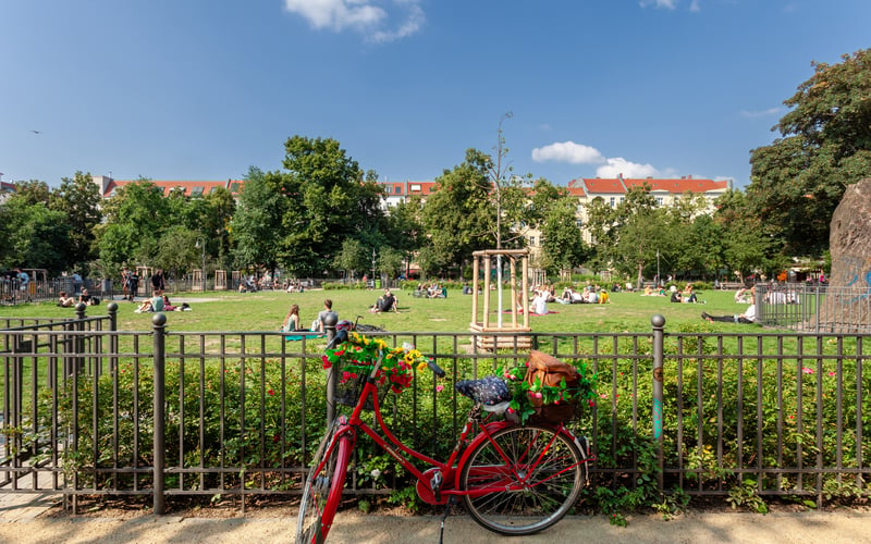
The district takes its name from the Kreuzberg, a rise of about 66 metres and thus the highest natural point in the inner city. On its summit stands the national monument to the Wars of Liberation designed by Karl Friedrich Schinkel, which gave the hill and later the whole district its name. Around it lies the Viktoriapark with its artificial waterfall, one of the few elevations from which the flat inner city can be surveyed.
Describing Kreuzberg rarely means describing a single picture. The district is made up of quarters with very different characters, from the middle-class Bergmannkiez in the south to the densely built streets around the Kottbusser Tor. For a long time the divide between the quieter western part and the louder, alternative-leaning eastern part was seen as defining. These differences blur today, yet the variety of its Kieze remains the dominant feature.
Kreuzberg is at the same time one of Berlin's most international districts. The share of residents with foreign nationality is around one third, and the Turkish community has been firmly rooted here for generations. This mix of structural density, cultural diversity and central location has made Kreuzberg one of Berlin's best-known addresses over the decades.
History and change
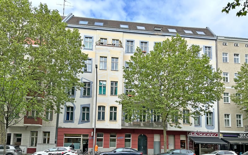
Kreuzberg emerged as a densely built working-class district of the Gründerzeit. In the course of industrialisation, large tenement blocks, the so-called Mietskasernen, were built from the 1860s onwards, multi-storey residential buildings with front, side and rear wings that allowed a high population density. Along the Oranienstraße and in what is now the Wrangelkiez, businesses settled that shaped the district well into the 20th century.
The labels Kreuzberg 36 and Kreuzberg 61, still common today, go back to the old West Berlin postal districts SO 36 and SW 61. Kreuzberg 61, the south-west around the Bergmannkiez, was considered more middle-class; Kreuzberg 36, the east between the Kottbusser Tor and the Schlesisches Tor, was poorer and more densely built. This postal distinction became a cultural attribution that followed the district for decades.
With the building of the Wall in 1961, Kreuzberg ended up on the edge of West Berlin. The district bordered directly on the Wall to the east and north and so became a peripheral, comparatively cheap location. Low rents and vacant period buildings drew students, artists and political activists. From the 1960s, Turkish labour migrants arrived in larger numbers, stayed in the district and brought their families. In the early 1980s, Kreuzberg became the centre of the West Berlin squatter movement, which fought against speculation and the decay of the period building stock.
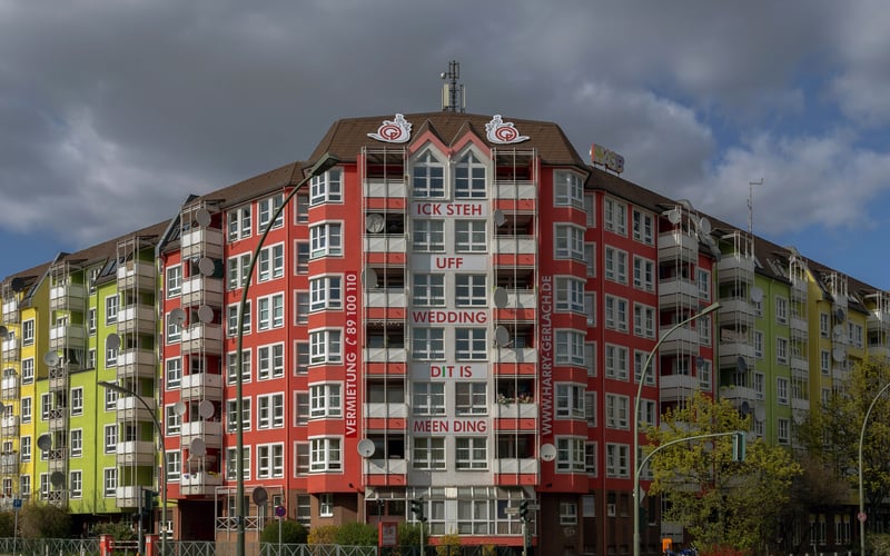
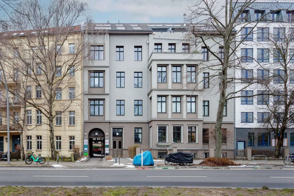
After the fall of the Wall, Kreuzberg moved out of its peripheral position and back into the geographic centre of the reunified city. The renovation of the period stock, neglected for decades, began in several formally designated redevelopment areas (Sanierungsgebiete). Weathered streets became sought-after residential locations. With this upgrading, the resident structure and rental conditions also changed, a shift that is still discussed controversially today and that the borough tries to steer through several milieu protection areas.
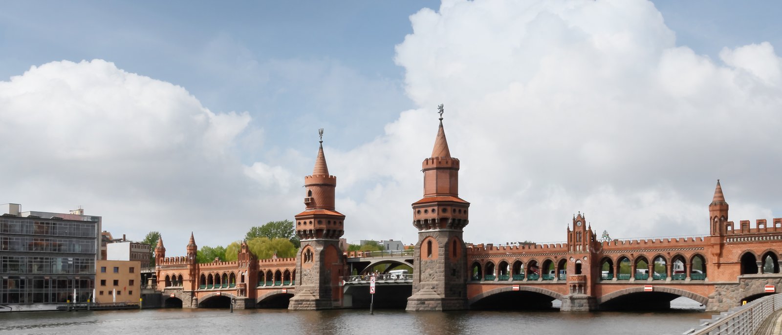
Since the administrative reform of 2001, Kreuzberg has formed the borough of Friedrichshain-Kreuzberg together with Friedrichshain, which lies north of the Spree. The two districts, separated by the border before the fall of the Wall, are connected by the Oberbaumbrücke, today one of the landmarks of the shared borough.
Sights
Kreuzberg's best-known points of interest are spread across the whole district. In the west, the Viktoriapark with its namesake hill and the Schinkel monument defines the picture. In the north, along the former border line, several sites of remembrance culture stand side by side: the Topography of Terror on the grounds of the former Gestapo headquarters, the nearby Checkpoint Charlie on the Friedrichstraße, which historically marked the border with neighbouring Mitte, and the remains of the Anhalter Bahnhof, whose ruin recalls the destroyed long-distance rail infrastructure.
Kreuzberg is also a museum location of national importance. The Jewish Museum Berlin with the new building designed by Daniel Libeskind, the Berlinische Galerie as the state museum of modern art, and the Gropius Bau as an exhibition venue all lie in the northern part of the district. The German Museum of Technology (Deutsches Technikmuseum) on the Trebbiner Straße, recognisable by the Berlin Airlift aircraft (Rosinenbomber) mounted on its roof, documents the transport and industrial history of the city.
In the east, the Oberbaumbrücke connects Kreuzberg with Friedrichshain. The Landwehrkanal runs through the district from west to east and shapes the townscape with its embankment streets, the Paul-Lincke-Ufer and the Engelbecken, as much as the numerous green spaces do. This density of landmarks, from remembrance culture and the museum landscape to the waterside locations, explains why Kreuzberg appears in national searches above all as a tourist and cultural destination.
Popular Kieze in Kreuzberg
Kreuzberg is divided into a series of distinctive Kieze, each with its own character:
- Bergmannkiez: The middle-class quarter around the Bergmannstraße and the Chamissoplatz, known for its intact Gründerzeit stock and the Marheineke Markthalle.
- Graefekiez: A densely built, internationally popular residential quarter on the Landwehrkanal, south of the Kottbusser Tor.
- Wrangelkiez: The quarter between the Schlesisches Tor and the Görlitzer Park, with the Markthalle Neun as its gastronomic anchor.
- Chamissokiez: One of the best-preserved Gründerzeit quarters in Berlin around the Chamissoplatz, closely tied to the Bergmannkiez.
- Viktoriaquartier: The locations around the Viktoriapark and the Kreuzberg, shaped by the elevation and newer residential projects.
- Quartier am Gleisdreieck: The streets around the park of the same name, where mid-sized residential projects have been built on former railway land in recent years.
In addition there are the busy locations around the Lausitzer Platz, the Oranienstraße and the Mariannenplatz, which shape the image of Kreuzberg 36 to this day.
Scene and everyday life
Everyday life in Kreuzberg takes place largely on the streets and at the markets. The Turkish Market on the Maybachufer, on the border with Neukölln along the Landwehrkanal, draws buyers from across the city twice a week. The Markthalle Neun in the Wrangelkiez has grown into a fixed meeting point with its market days and events, and the Marheineke Markthalle supplies the Bergmannkiez.
The dining scene ranges from Turkish and Arabic cuisine around the Kottbusser Tor to the restaurants on the Mehringdamm and the cafés along the embankments of the Landwehrkanal. With the SO36 on the Oranienstraße, one of the oldest clubs still operating in the city lies in Kreuzberg, and the district's galleries are part of the Berlin art scene.
Over the course of the year, several large events shape the public space. The Carnival of Cultures (Karneval der Kulturen) moves through the district with a street parade at Whitsun, and the Myfest around 1 May concentrates the action in the area around the Mariannenplatz and the Oranienstraße. These events have been part of the fixed image of Kreuzberg for years and shape its perception beyond the city limits.
Who lives in Kreuzberg
Kreuzberg's population is young and organised in small units. One- and two-person households make up the majority, and large households are rarer. The following distribution shows how household sizes are split in the district.
| Household size | Count | Share |
|---|---|---|
| 1 person | 48,430 | 63 % |
| 2 people | 13,595 | 18 % |
| 3 people | 6,648 | 9 % |
| 4 people | 4,657 | 6 % |
| 5 people | 1,940 | 3 % |
| 6+ people | 1,637 | 2 % |
The age structure underlines the picture of a district where the middle working age dominates, while the marginal groups, very young and older residents, are less strongly represented than in the Berlin average. This is linked to the high turnover and Kreuzberg's appeal to younger newcomers.
| Age group | Count | Share |
|---|---|---|
| under 6 | 6,808 | 5 % |
| 6–15 | 11,096 | 7 % |
| 15–18 | 3,941 | 3 % |
| 18–27 | 16,409 | 11 % |
| 27–45 | 51,011 | 34 % |
| 45–55 | 21,522 | 14 % |
| 55–65 | 19,925 | 13 % |
| 65+ | 19,961 | 13 % |
Its international character is defining. About one third of residents hold a foreign nationality, with the individual groups of origin each forming large communities. The historically rooted Turkish population is complemented by younger arrivals from European and non-European countries. The following overview shows the composition by origin.
| Region of origin | Count | Share |
|---|---|---|
| Turkey | 22,658 | 33 % |
| EU | 20,006 | 29 % |
| unassigned | 6,796 | 10 % |
| USA | 2,810 | 4 % |
| Ukraine | 2,494 | 4 % |
| Lebanon | 2,473 | 4 % |
| United Kingdom | 1,984 | 3 % |
| Syria | 1,977 | 3 % |
| India | 1,808 | 3 % |
| Russia | 1,524 | 2 % |
| Iran | 883 | 1 % |
| Iraq | 746 | 1 % |
| Afghanistan | 622 | <1 % |
| Vietnam | 528 | <1 % |
| China | 471 | <1 % |
| Kazakhstan | 217 | <1 % |
Who is drawn to Kreuzberg
Kreuzberg is a district with high mobility. The growth of recent years rests largely on international inflows, while the district loses residents in its exchange with the rest of Berlin and the surrounding region. The following three overviews place these movements in context.
Across the city boundary, Kreuzberg is fed above all by inflows from abroad. The balances by country of origin show which nations shape the district and how strongly arrivals and departures interlock.
| # | Country | Inflow | Outflow | Net |
|---|---|---|---|---|
| 1 | Ukraine | 645 | 340 | 305 |
| 2 | Indien | 589 | 177 | 412 |
| 3 | Vereinigte Staaten | 521 | 428 | 93 |
| 4 | Türkei | 485 | 317 | 168 |
| 5 | Italien | 260 | 305 | -45 |
| 6 | Frankreich | 186 | 300 | -114 |
| 7 | Spanien | 146 | 165 | -19 |
| – | Deutschland | 2,369 | 2,906 | -537 |
Within Berlin, Kreuzberg is in close exchange with the directly neighbouring districts. The interlinking with Neukölln to the south is especially pronounced, followed by Friedrichshain across the Spree. The source areas show from which parts of the city people move to Kreuzberg.
| # | District | People |
|---|---|---|
| 1 | Neukölln | 1,137 |
| 2 | Friedrichshain | 678 |
| 3 | Prenzlauer Berg | 531 |
| 4 | Schöneberg | 507 |
| 5 | Mitte | 415 |
For departures the picture shifts towards the city edge and the surrounding region. Those who leave Kreuzberg move on balance preferably to Neukölln, to districts further east, or into the Brandenburg surroundings, for instance to Potsdam and the adjacent counties. This movement is typical of central, densely built locations with a small housing stock and little family housing.
| # | District | People |
|---|---|---|
| 1 | Neukölln | 1,184 |
| 2 | Friedrichshain | 738 |
| 3 | Mitte | 585 |
| 4 | Schöneberg | 580 |
| 5 | Prenzlauer Berg | 550 |
Buildings and apartments
Kreuzberg's housing stock is shaped by Gründerzeit period buildings. The average apartment size is well below the Berlin average, which reflects the small layout of many period apartments and the high density. The following distribution shows how living areas are graded in the district.
| Size class | Count | Share |
|---|---|---|
| Unter 40 m² | 10,933 | 14 % |
| 40-59 m² | 23,732 | 30 % |
| 60-79 m² | 20,958 | 26 % |
| 80-99 m² | 12,941 | 16 % |
| 100-119 m² | 5,689 | 7 % |
| 120-139 m² | 2,660 | 3 % |
| 140-159 m² | 1,270 | 2 % |
| 160-179 m² | 581 | <1 % |
| 180-199 m² | 238 | <1 % |
| 200+ m² | 330 | <1 % |
In terms of use, owner-occupied and rented housing predominates; commercial and mixed uses concentrate on the main streets such as the Oranienstraße and the Mehringdamm. The following split sorts the types of use.
| Type of use | Count | Share |
|---|---|---|
| Rented | 71,880 | 88 % |
| Owner-occupied | 5,580 | 7 % |
| Vacant | 1,756 | 2 % |
| Commercial | 2,084 | 3 % |
The stock is dominated by Gründerzeit buildings. Apartments from the post-war years between 1950 and 1978, as well as newer buildings from 1979 onwards, are less strongly represented and are found mainly where war gaps were closed or former railway and commercial land, such as at the Gleisdreieck, was built over. New construction is low compared with other Berlin locations, owing to the limited supply of land and the dense development. The following illustration shows how construction activity has developed over time.
| Period | Apartment balance |
|---|---|
| 2021 | 442 apartments |
| 2022 | 50 apartments |
| 2023 | 347 apartments |
| 2024 | -57 apartments |
An additional factor for the housing market is the regulatory situation. Large parts of Kreuzberg's residential quarters lie in milieu protection areas, where the borough steers conversions and structural changes through conservation statutes. These areas cover a substantial share of the living space and shape the framework for owners and investors.
Transport and infrastructure
Kreuzberg is served by several U-Bahn lines. Characteristic is the elevated U1/U3 line, whose viaduct runs along the Skalitzer and Gitschiner Straße and connects the stations Schlesisches Tor, Görlitzer Bahnhof, Kottbusser Tor, Prinzenstraße and Hallesches Tor. Crossing it are the U6 via Mehringdamm and Hallesches Tor, the U7 via Mehringdamm, Gneisenaustraße and Südstern, and the U8 via Moritzplatz, Kottbusser Tor and Schönleinstraße. With the intersection of the U1, U3 and U8, the Kottbusser Tor is one of the district's most important transport hubs.
In the north, the S-Bahn stops Anhalter Bahnhof and Yorckstraße connect the district to the north-south tunnel and the ring, and the Möckernbrücke station links the U-Bahn with regional services. The network is rounded out by a dense bus offer and well-developed cycle connections along the Landwehrkanal and the main streets.
The green spaces are spread across the district. The Görlitzer Park on the grounds of the former Görlitzer Bahnhof, the Viktoriapark with the Kreuzberg, and the Park am Gleisdreieck on former railway land form the largest connected open spaces; the Tempelhofer Feld adjoining to the south rounds out the offer. Educational facilities, local supply and retail concentrate along the main axes, so that most quarters are supplied within walking distance. This combination of dense public transport, short distances and central location is among the defining locational features of Kreuzberg.
Who Kreuzberg suits
From the population structure, housing stock and location, a few profiles can be derived that Kreuzberg particularly suits:
- Internationally oriented professionals: The central location, the good public transport links and the pronounced international character make the district attractive for mobile, often multilingual workers.
- Singles and couples without children: The high share of small apartments and one- to two-person households suits residents who want to live centrally and compactly.
- Creatives and the self-employed: The dense cultural, gallery and dining scene, as well as the proximity to workplaces in the inner city, fits freelance and creative work.
- Investors with a long horizon: Period stock in a sought-after location holds its value over the long term; the milieu protection areas, however, set tight conditions for conversion and modernisation that belong in the calculation.