Character and Identity
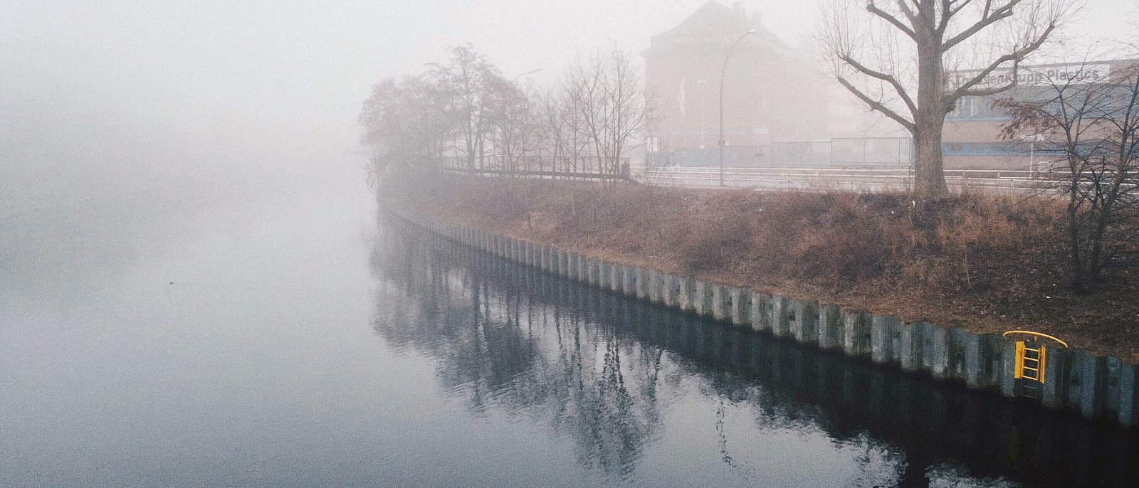
Moabit belongs to the borough of Mitte and sits as its own island in central Berlin, surrounded by the Spree to the south and east and by the Berlin-Spandau shipping canal and the Westhafen canal to the north and west. The district is home to 84,913 residents; its housing stock is spread across 46,124 apartments and 44,859 households (source: Amt für Statistik Berlin-Brandenburg).
The island setting still shapes the district today. To reach Moabit you cross one of its many bridges, and traffic concentrates on a few axes. Inside lie dense, almost self-contained Gründerzeit Kieze with quiet residential streets, 30 km/h zones and small-scale gastronomy. Turmstraße runs as a lifeline from east to west through the district, bundling retail, administration and local amenities.
For a long time Moabit was regarded as an insider tip close to the city centre, with comparatively affordable residential locations, wedged between the government quarter, the central station and the Westhafen harbour. That peripheral status has turned around. With Europacity north of the central station and the development along Lehrter Straße, the district is moving closer to Berlin's central locations, while the old working-class Kieze retain their own character.
In the north Moabit shows a different face. Around the Westhafen and along Beusselstraße the district remains industrial and commercial in character, with harbour basins, logistics and large employers. This mix of dense residential quarter, administrative location and harbour town makes Moabit one of the most heterogeneous districts in the borough of Mitte.
History and Change
The name Moabit goes back to Huguenots who settled in the 18th century on what was then still sandy, inhospitable land outside the gates of Berlin. With industrialisation in the 19th century the island changed fundamentally. Its location between the waterways made Moabit a preferred site for factories and engineering works, and dense tenement quarters for the workforce sprang up along the new plants. Between 1858 and 1890 the population grew from around 10,000 to about 93,000 people, living in extremely cramped and precarious conditions (source: Guthmann market report, historical context).
During the Weimar Republic and the early 1930s Moabit was a flashpoint of political conflict. The working-class quarters were the scene of street battles, and the district was temporarily nicknamed the Red Island of Resistance. In the Second World War Moabit was hit hard. The Beusselkiez was partly destroyed by air raids in 1943, and in the final days of the war a large part of the housing stock fell victim to the fighting. These losses explain the high share of post-war buildings between the surviving Gründerzeit blocks that persists to this day.
With the division of Berlin, Moabit lay in the western part of the city, right on the border with the East Berlin centre. After reunification the district moved back towards the city centre, and over the years new quarters emerged from the former wall and railway wasteland along Lehrter Straße and north of the central station. A redevelopment area has existed around Turmstraße since 2011, intended to strengthen the small-scale retail structure as part of the Aktive Zentren initiative. A former large brewery was turned into the Schultheiss Quartier with retail on Turmstraße. Moabit contains several conservation areas under § 172 BauGB (source: Bezirksamt Mitte).
Sights
Moabit's landmark is the criminal court on Turmstraße, one of the largest court buildings in Europe, whose name is known far beyond the district as a synonym for Berlin's criminal justice system. Alongside it, sacral buildings shape the cityscape, including the Johanniskirche designed by Karl Friedrich Schinkel and the Heilandskirche on the bank of the shipping canal.
A lively anchor point is the Arminiusmarkthalle near Turmstraße, a preserved market hall from the imperial era that today combines a weekly market, gastronomy and events. The Kleiner Tiergarten and the adjoining Ottopark form a green axis in the middle of the dense residential area, while the Fritz-Schloß-Park with the Poststadion, on the site of a former fortress rampart, provides the district's largest green space.
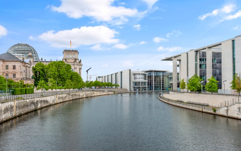
On the south-western edge, the grounds of the former Moabit cellular prison, today a history park, recall the district's eventful past. The Westhafen with its harbour basins and warehouse buildings is an industrial monument in its own right and at the same time a working inland port. To the south, the Spree and the Spreebogen waterfront opposite the government quarter form a striking water's edge.
Popular Kieze in Moabit
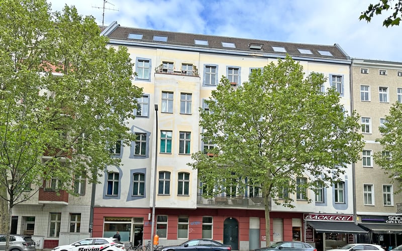
- Stephankiez: A star-shaped quarter with the highest share of preserved Gründerzeit fabric in Moabit, characterised by stucco façades, quiet residential streets and small-scale gastronomy.
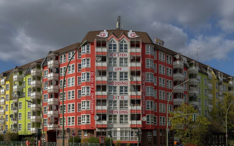
- Beusselkiez: A working-class quarter in the west, heavily destroyed in the war and accordingly shaped by post-war buildings, with dense development and proximity to the Westhafen.
- Huttenkiez: A western Kiez with a mixed residential and commercial structure, on the border with the industrial harbour areas.
- Stephanplatz and Lübecker Straße: Residential locations between Turmstraße and the canal with Gründerzeit blocks and good connections via the U9.
- Heidestraße / Europacity: A new quarter north of the central station on former railway land, with offices, new-development apartments and a link to the central city centre.
- Lehrter Straße: An elongated quarter along the former railway and wall wasteland with more than a thousand new rental and owner-occupied apartments.
Scene and Everyday Life
Everyday life in Moabit unfolds along Turmstraße and in the side streets of the Gründerzeit Kieze. The Arminiusmarkthalle is both a gastronomic meeting place and a supply hub, complemented by weekly markets and a small-scale, internationally influenced retail structure. Cafés, bars and restaurants concentrate on the quiet residential streets around the Stephankiez and along the axes towards the Kleiner Tiergarten.
The district has its own art and grassroots scene, expressed in studios, project spaces and neighbourhood initiatives around Turmstraße and the Beusselkiez. Proximity to the water shapes leisure: the waterside paths along the shipping canal, the Westhafen and the Spree promenade opposite the government quarter are local recreation areas in the middle of the city. With the Fritz-Schloß-Park, the Poststadion and the Kleiner Tiergarten, Moabit has more contiguous greenery than its dense development might at first suggest.
Who Lives in Moabit
Moabit is a densely populated, small-scale district with a high share of small households. The following breakdown shows how households are distributed by size.
| Household size | Count | Share |
|---|---|---|
| 1 person | 29,694 | 66 % |
| 2 people | 7,729 | 17 % |
| 3 people | 3,536 | 8 % |
| 4 people | 2,285 | 5 % |
| 5 people | 837 | 2 % |
| 6+ people | 778 | 2 % |
The age structure is shaped by working-age people in the middle age groups and young adults, typical of a central quarter with predominantly small apartments.
| Age group | Count | Share |
|---|---|---|
| under 6 | 4,123 | 5 % |
| 6–15 | 5,615 | 7 % |
| 15–18 | 1,863 | 2 % |
| 18–27 | 10,562 | 12 % |
| 27–45 | 32,773 | 39 % |
| 45–55 | 9,527 | 11 % |
| 55–65 | 9,316 | 11 % |
| 65+ | 11,134 | 13 % |
Moabit has always had an international character. The 19th-century working-class quarter has become a district with a high share of residents of international origin. The composition of the resident population by region of origin is shown in the following overview.
| Region of origin | Count | Share |
|---|---|---|
| EU | 12,465 | 35 % |
| Turkey | 6,437 | 18 % |
| unassigned | 2,459 | 7 % |
| India | 2,427 | 7 % |
| Ukraine | 1,956 | 5 % |
| Russia | 1,706 | 5 % |
| Syria | 1,701 | 5 % |
| Lebanon | 1,625 | 5 % |
| USA | 935 | 3 % |
| Iran | 920 | 3 % |
| United Kingdom | 798 | 2 % |
| China | 679 | 2 % |
| Afghanistan | 517 | 1 % |
| Iraq | 470 | 1 % |
| Vietnam | 467 | 1 % |
| Kazakhstan | 207 | <1 % |
Who Is Drawn to Moabit
The migration data shows how the population renews itself. Moabit grows mainly through inflows from abroad and from the rest of Germany, while the exchange with the surrounding area and with other Berlin districts dampens the balance.
| # | Country | Inflow | Outflow | Net |
|---|---|---|---|---|
| 1 | Indien | 665 | 246 | 419 |
| 2 | Türkei | 260 | 164 | 96 |
| 3 | Ukraine | 222 | 179 | 43 |
| 4 | Polen | 162 | 148 | 14 |
| 5 | Arabische Republik Syrien | 139 | 71 | 68 |
| 6 | Italien | 130 | 106 | 24 |
| 7 | Bulgarien | 126 | 170 | -44 |
| – | Deutschland | 1,798 | 2,110 | -312 |
Within Berlin, the exchange runs closely with the adjacent inner-city districts and the locations adjoining to the west.
| # | District | People |
|---|---|---|
| 1 | Charlottenburg | 413 |
| 2 | Mitte | 396 |
| 3 | Wedding | 311 |
| 4 | Gesundbrunnen | 292 |
| 5 | Kreuzberg | 290 |
In the opposite direction a similarly small-scale picture emerges, with a tendency towards the surrounding area and the neighbouring boroughs.
| # | District | People |
|---|---|---|
| 1 | Charlottenburg | 519 |
| 2 | Wedding | 383 |
| 3 | Gesundbrunnen | 340 |
| 4 | Prenzlauer Berg | 333 |
| 5 | Mitte | 316 |
Buildings and Apartments
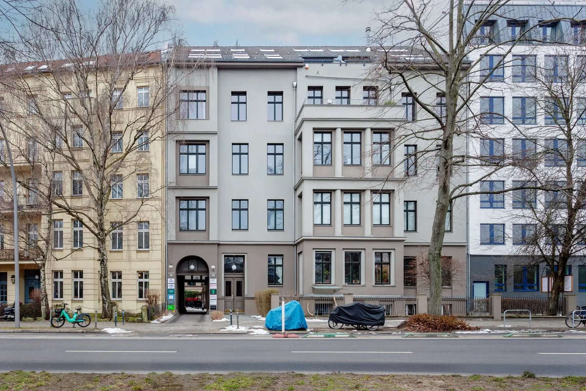
The building stock comprises 2,967 buildings. The wartime destruction has shaped the stock to this day: the surviving Gründerzeit blocks are followed by a high share of post-war buildings, which account for around half of the building stock. While the Stephankiez has largely preserved its historical character, post-war decades dominate in quarters destroyed in the war, such as the Beusselkiez. No chart data source for construction periods is available; this assessment is based on the Guthmann market report.
The housing stock is small-scale and characterised by small to medium-sized units, matching the high share of small households. The following overview shows how the stock is distributed across the size classes.
| Size class | Count | Share |
|---|---|---|
| Unter 40 m² | 7,018 | 15 % |
| 40-59 m² | 15,345 | 33 % |
| 60-79 m² | 11,600 | 25 % |
| 80-99 m² | 6,531 | 14 % |
| 100-119 m² | 3,221 | 7 % |
| 120-139 m² | 1,362 | 3 % |
| 140-159 m² | 535 | 1 % |
| 160-179 m² | 266 | <1 % |
| 180-199 m² | 127 | <1 % |
| 200+ m² | 119 | <1 % |
The use of the stock is also informative about the social mix of the district.
| Type of use | Count | Share |
|---|---|---|
| Rented | 41,696 | 89 % |
| Owner-occupied | 3,441 | 7 % |
| Vacant | 913 | 2 % |
| Commercial | 807 | 2 % |
New construction in Moabit emerges almost exclusively at the edges, above all on the former railway and wasteland sites of Europacity and along Lehrter Straße. In the densely built interior of the island, the scope for new construction remains limited.
| Period | Apartment balance |
|---|---|
| 2021 | 135 apartments |
| 2022 | 216 apartments |
| 2023 | 536 apartments |
| 2024 | 444 apartments |
Transport and Infrastructure
Despite its island setting, Moabit is well connected. The U9 crosses the district from south to north with the stations Hansaplatz, Turmstraße, Birkenstraße and Westhafen, linking it with the Kurfürstendamm in the south and Wedding in the north. The S-Bahn ring line touches Moabit at its western edge with the Westhafen and Beusselstraße stations, where there is also an interchange to the U9.
Berlin's central station lies immediately on the south-eastern edge of the district and connects Moabit directly to the long-distance and regional rail network. Via the numerous bridges and the main axes Turmstraße, Stromstraße and Beusselstraße, the district is linked to the rest of the road network. The waterside paths along the shipping canal and the Spree form a contiguous network for cyclists and pedestrians.
Local amenities concentrate on Turmstraße with the Schultheiss Quartier and the Arminiusmarkthalle, as well as on the retail locations of the side Kieze. Schools, daycare centres and administrative facilities lie within the residential surroundings; the Rathaus Tiergarten and the criminal court define the administrative location on Turmstraße. Green spaces are distributed across the district with the Kleiner Tiergarten, the Ottopark and the Fritz-Schloß-Park, complemented by the waterside locations on the canal and at the Westhafen.
In the north Moabit remains industrial in character through the Westhafen. The inland port is a major logistics location and employer, and the commercial land reserves along Beusselstraße and at the harbour form an economic area of their own within the district.
Who Moabit Suits
- Professionals close to the city: A high share of small apartments and households, plus short distances to the central station, the government quarter and the offices of Europacity. The supply is predominantly rental.
- First-time buyers and owner-occupiers: Those looking for a central location will find a spectrum in the Gründerzeit Kieze and the new-development quarters along Lehrter Straße that ranges from renovated period buildings to new-development apartments.
- Water and city lovers: The island setting between the Spree and the canal, with its waterside paths, appeals to residents who want to combine a central location with a water's edge.
- Investors with an eye on development: A scarce, small-scale stock, sustained rental demand from the surrounding office locations and proximity to Europacity shape the market; the conservation areas regulate conversion and modernisation.